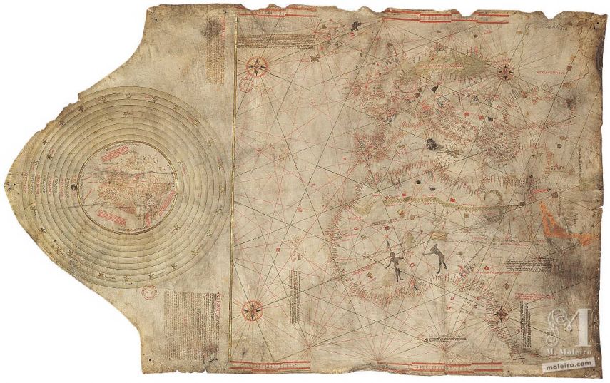
In 1924, Charles de la Roncière, a French historian and cartography expert, attributed to Christopher Columbus a portulan navigation chart which has since been the subject of debate and discussion.
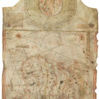
The navigation chart shows the classical design of the Mediterranean area with the addition of the Atlantic coastlines stretching from the south of Scandinavia to the mouth of the river Congo. It features a particularly comprehensive nomenclature of the entire African coast – an area where Columbus is believed to have undertaken at least one voyage with the Portuguese. To the East it encompasses the Black Sea and the Red Sea, and to the West, a series of islands, some real and some imaginary, stretching from the Artic to the Gulf of Guinea.
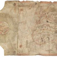
The elongated part of the parchment shows a small, circular mappa mundi with Jerusalem in the middle surrounded by heavenly rings symbolising the geocentric concept of the universe. Practical navigation charts are not often found alongside cosmographic maps. One of the accompanying notes in Latin says that despite being plotted on a flat surface, the mappa mundi must be thought of as spherical. The portrayal of the earth in this manner confirms the evolution of maps between the Middle Ages and the Renaissance.
The Spanish flag painted over Granada reveals that the map was completed after January 1492, following the conquest of the Muslim city by the Catholic monarchs. Unlike Juan de la Cosa’s planisphere dated 1500 and subsequent maps, no attempt is made in this map to show the new discoveries that were made from 1493 onwards, an indication that it was made in early 1492.