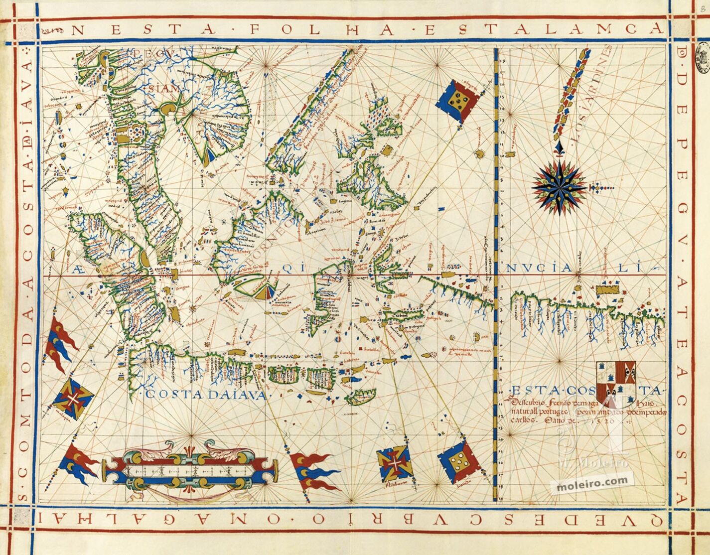
Map No. 8. Southeast Asia and the coast discovered by Ferdinand Magellan up to the coast of Java
About two-fifths of this map is derived from the previous chart: the entire space north of the Equator and west of the latitude scale can already be seen. The large regions depicted herein extend from the Malay Peninsula, Indo-China and Sumatra up to Java, the Sunda Islands (with Solor and Timor) and the Moluccas and New Guinea, divided by the Equator into two equal parts: 19º towards the north and 19º towards the south. The presence of the sequence of the islands of Sumatra, Java and the Sunda archipelago, towards the Moluccas, dates from the early decades of the sixteenth century in Portuguese cartography. In the maps inserted into the Livro de Francisco Rodrigues, dating from c. 1513 or in the map of the Indian Ocean attributed to Pedro Reinel, dating from c. 1517, it is possible to glimpse Vaz Dourado’s remote predecessors.
The four flags that indicate the Portuguese presence and possession of various places and territories have been scattered over Malacca, the Moluccas and the islands of the Banda Sea (Banda and Ambon). In the lower right corner, under an expanded and detailed rectilinear coast, east of the Tordesillas anti-meridian indicated by the latitude scale, it is possible to see the symbol of Spanish possession of territories: a shield bearing the coats of arms of Castile/León and Aragon/Sicily. The following inscription surrounds the shield: “This coast was discovered by Ferdinand Magellan, a native of Portugal, on the orders of Emperor Charles in the year 1520.” However, the east-west coast depicted, continued on the following folio, illustrates one or various nautical itineraries, parallel to the Equator, 4º south of it. This is clearly the northern coast of New Guinea, which Magellan did not visit and which was first explored by Dom Jorge de Meneses, on the Portuguese side, and by Álvaro de Saavedra, on the Spanish side, in 1527, and later, in greater detail, by Villalobos and Iñigo de Retes, who conferred the island’s name in 1545.
João Carlos Garcia
Faculdade de Letras, Universidade do Porto
(Fragment of the Universal Atlas of Fernão Vaz Dourado commentary volume)
