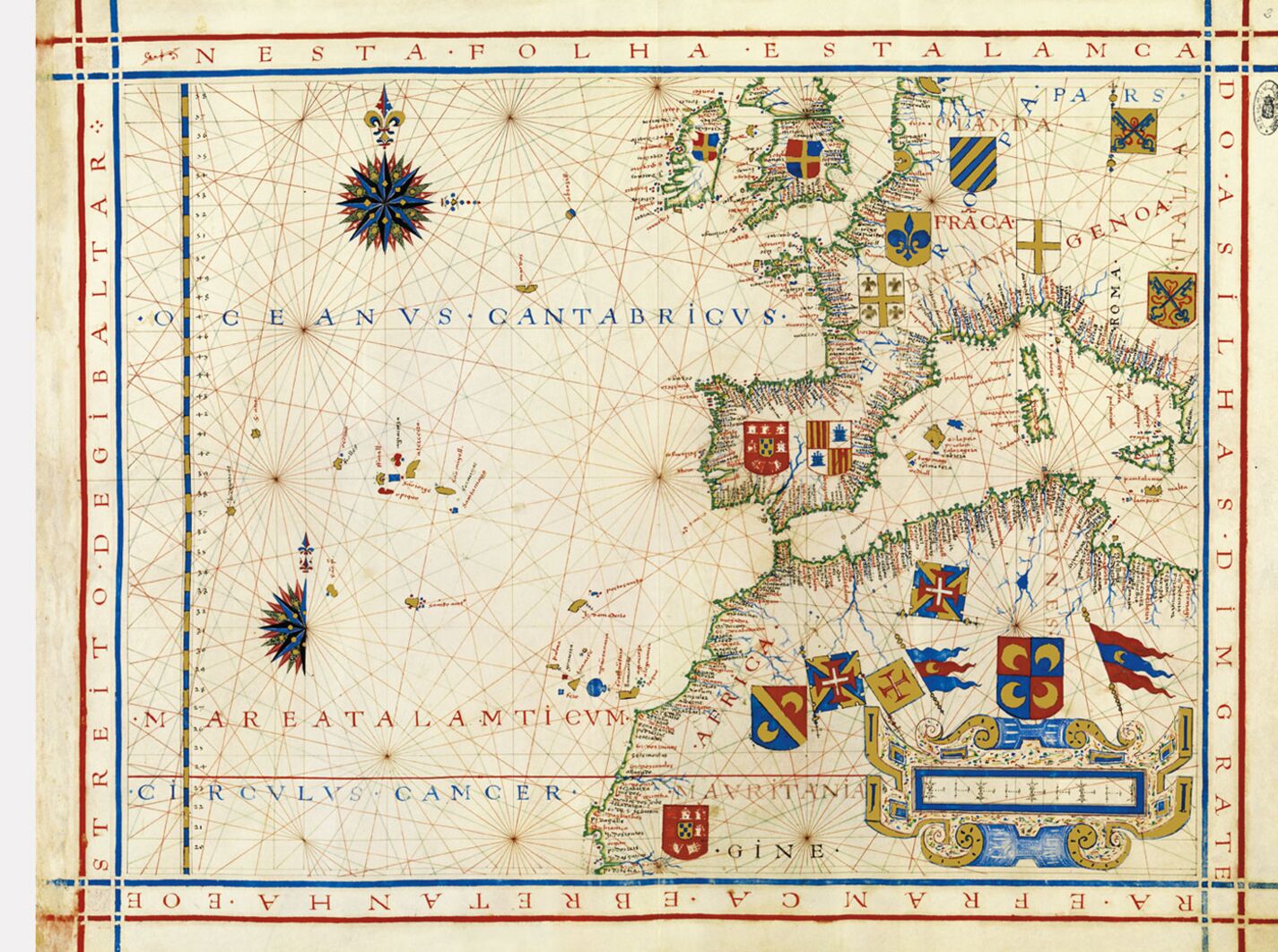
Map No. 2. United Kingdom, Southern Europe and North of Africa
This folio depicts all of Western Europe, from Hamburg and the British Isles up to Mauritania (19º N), including northwest Africa and the western and central Mediterranean up to Sicily. The Tropic of Cancer serves as the base of the map.
Only two names have been provided for the vast expanses of ocean that occupy the left half of the map: to the north, the “Oceanvs Cantabricvs”, along the 47º N parallel and the “Mare Atalamticvm”, south of the Canary Islands, southwest of the chain of mountains identified as the Atlas mountains. The archipelagos of the Azores, Madeira and the Canary Islands have been clearly identified but, west and southwest of the Azores, some of the classic mythical islands continue to survive in these hydrographic maps of well-known spaces: St. Peter, St. Anthony, St. Anne.
The Portuguese presence is indicated by the sites where the flags of the Order of Christ have been placed: Arzila and Ceuta, controlling the Strait of Gibraltar, and Mazagão (El Jadida), on the Moroccan coast, Portugal’s most important military stronghold. The Portuguese coat of arms is depicted on a shield near the well-delineated regional toponyms of “Gine”, as opposed to two other shields in the interior of the continent (“Africa” and “Tvnes”), with Islamic crescents.
João Carlos Garcia
Faculdade de Letras, Universidade do Porto
(Fragment of the Universal Atlas of Fernão Vaz Dourado commentary volume)
