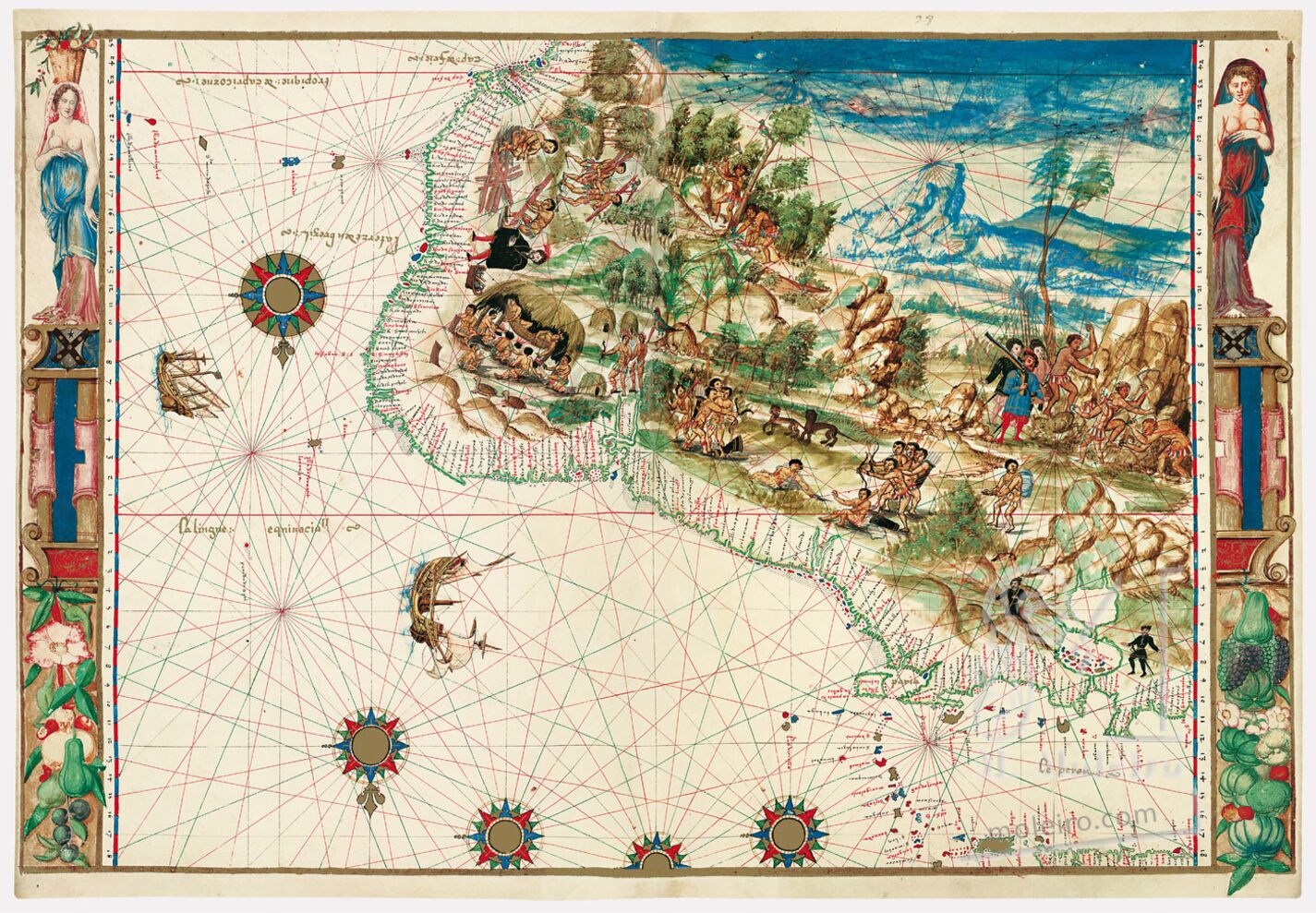
The one of northeastern South America is the only New World map with illustrated right and left margins. While the latitude markers are still present, the distance scales are gone. Replacing them from top to bottom are two distinct female caryatids, one on each side, standing on pedestals, with the Vallard family crest just below the maidens. The woman on the left has a basket of fruit and other harvested foodstuffs on her head. The pedestals rest upon displays of yet more New World produce (squash, peppers, muscadines, etc.). These artful displays are allegorical, perhaps representing the bounty and promise of the Americas.
Out to sea are two ships, one lateen rigged, and five compass roses. On the mainland there is again the double Lake Maracaibo and no Orinoco. The many Indians are warring, hunting, gathering wood, and mining while being observed by and trading with six Europeans, some with firearms. In their village, the Indians are cooking and eating and reclining on a hammock. Turtles, birds, and jungle cats abound.
Dennis Reinhartz
Emeritus professor at the University of Texas in Arlington
(Exert from the commentary volume Atlas Vallard)