See more reviews
()
+ 7
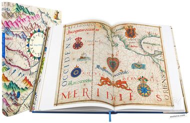
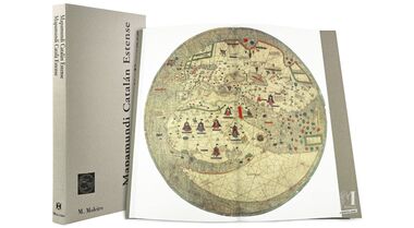
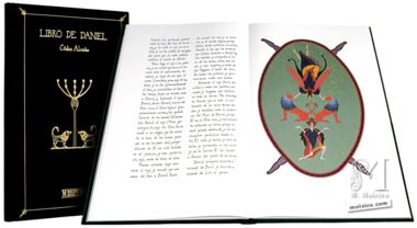
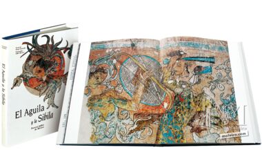
The Atlas Miller is considered to be one of the most stunning cartographic monuments in history, replete with luxurious artistic decoration which is undoubtedly the work of the renowned illuminator Antonio de Holanda. Ordered by King Manuel I of Portugal and brought to fruition by the Portueges Reinels and Homems cartographic workshops, the atlas is known as much for its political intrigue as for its beauty.
The geographical areas depicted in the atlas are the North Atlantic Ocean, Northern Europe, the Azores Archipelago, Madagascar, the Indian Ocean, Insulindia, the China Sea, the Moluccas, Brazil, the Atlantic Ocean and the Mediterranean. The folios reflect errors which demonstrate the limitations of contemporary knowledge, as well as the possibility of cartography as a means of delivering political jibes.
In our luxury-edition 432-page book of art, complete with 359 full-colour images, our experts delve into the world of 16th-century cartography and the creation and secrets of the Atlas Miller, which hides as much as it reveals.
Read more
Read less
The Atlas Miller is considered to be one of the most stunning cartographic monuments in history, replete with luxurious artistic decoration which is undoubtedly the work of the renowned illuminator Antonio de Holanda. Ordered by King Manuel I of Portugal and brought to fruition by the Portueges Reinels and Homems cartographic workshops, the atlas is known as much for its political intrigue as for its beauty.
The geographical areas depicted in the atlas are the North Atlantic Ocean, Northern Europe, the Azores Archipelago, Madagascar, the Indian Ocean, Insulindia, the China Sea, the Moluccas, Brazil, the Atlantic Ocean and the Mediterranean. The folios reflect errors which demonstrate the limitations of contemporary knowledge, as well as the possibility of cartography as a means of delivering political jibes.
In our luxury-edition 432-page book of art, complete with 359 full-colour images, our experts delve into the world of 16th-century cartography and the creation and secrets of the Atlas Miller, which hides as much as it reveals.
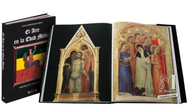
Contents:
Authors:

Contents:
Authors: