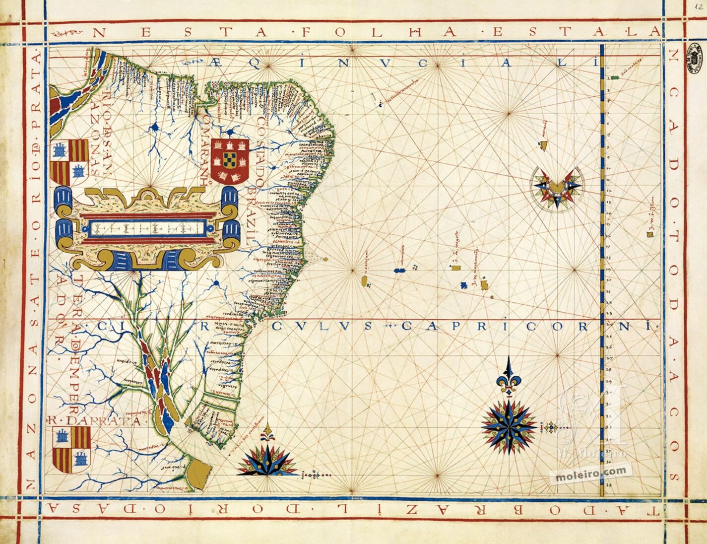
Map No. 12. Coast of Brazil
Brazil is the Portuguese South America, between the Equator, which establishes the margin at the top of the map, and the Rio de la Plata; between the Tordesillas meridian to the west and the South Atlantic to the east, which, although not identified occupies half the map. The complementary nature of maritime and continental spaces and the decisive importance of the former are quite evident in this folio. The locations of islands and archipelagos are related by means of maritime routes (not depicted), as is the case with the alignment of islands and islets between 18ºS and 21ºS, in an East-West direction.
Unlike the case in other corresponding folios, in Vaz Dourado’s atlases, Brazil is not depicted as an island separated from the continent by the river basins of the Amazon or the Maranhão and Rio de la Plata. The Maranhão does not extend too far south and largely occupies the interior of the continent. An ostentatious graphic scale is drawn over a large part of the unknown space, in the centre of the territory.
This interior is divided up into “great regions”: the “Coast of Brazil”, “The Maranhão”, the “Amazon River”, the “Rio de la Plata” and, on the Spanish side, which bears two shields (to the north and south), with the coat of arms of Castile/Aragon, the “Land of the Emperor”. The shield with the Portuguese coat of arms, in Northern Brazil, dominates the entire map.
The greater or lesser density of toponyms along the coasts corresponds, naturally, to a greater or lesser concentration of European colonisation.
João Carlos Garcia
Faculdade de Letras, Universidade do Porto
(Fragment of the Universal Atlas of Fernão Vaz Dourado commentary volume)
